Communication Network Prototype for Monitoring of Small Fishing Boats
IoT System Completed FeaturedAn undergraduate thesis project developing a LoRa-based communication prototype for monitoring small fishing boats (bangka) in the Philippines. Despite achieving 882-meter range and functional network operations, the research identified key limitations and provided recommendations for future improvements in maritime IoT systems.


Timeline
Started: September 1, 2023
Completed: May 1, 2024
Technologies
 Arduino
  LoRa
LoRa  IoT
IoT  Flutter
  Firebase
  Raspberry Pi
 Category
IoT SystemKey Features
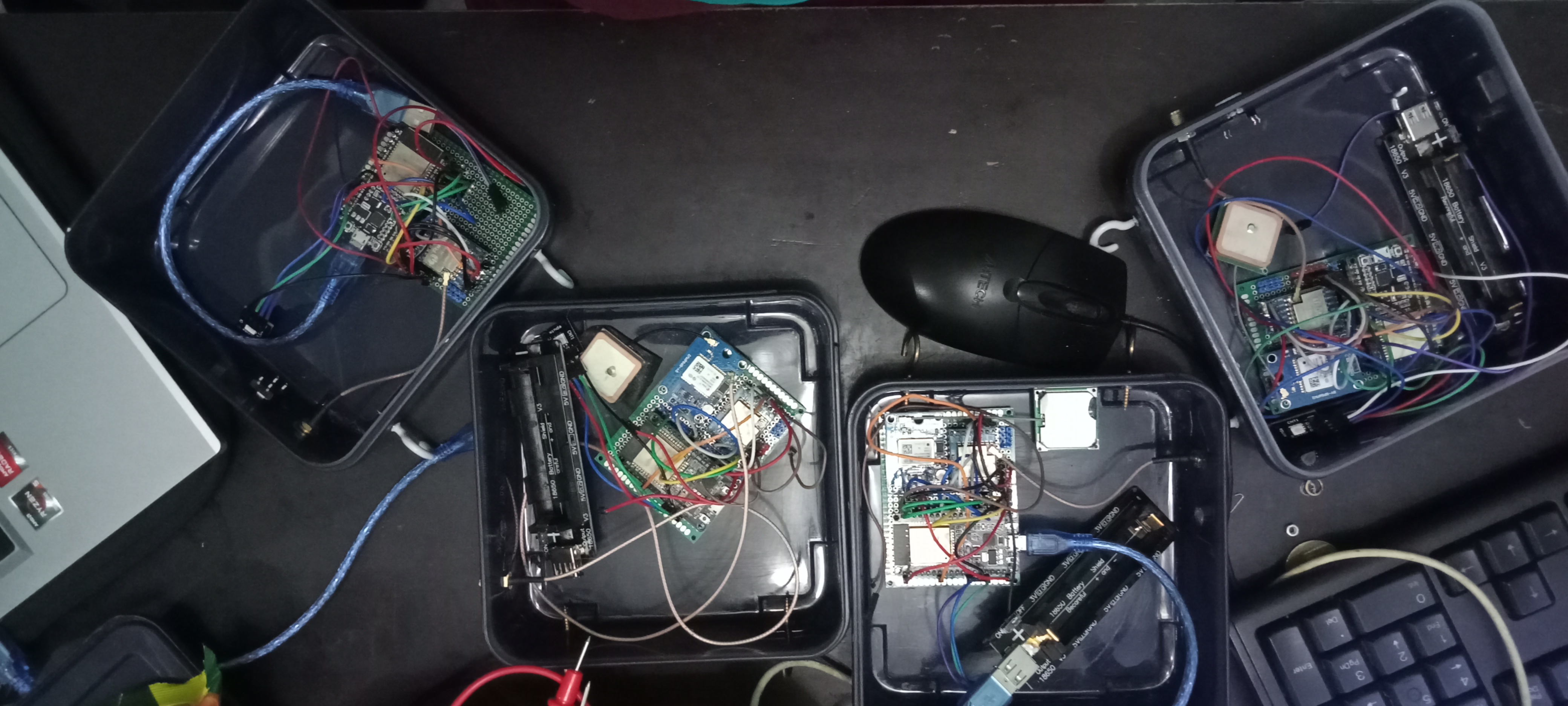
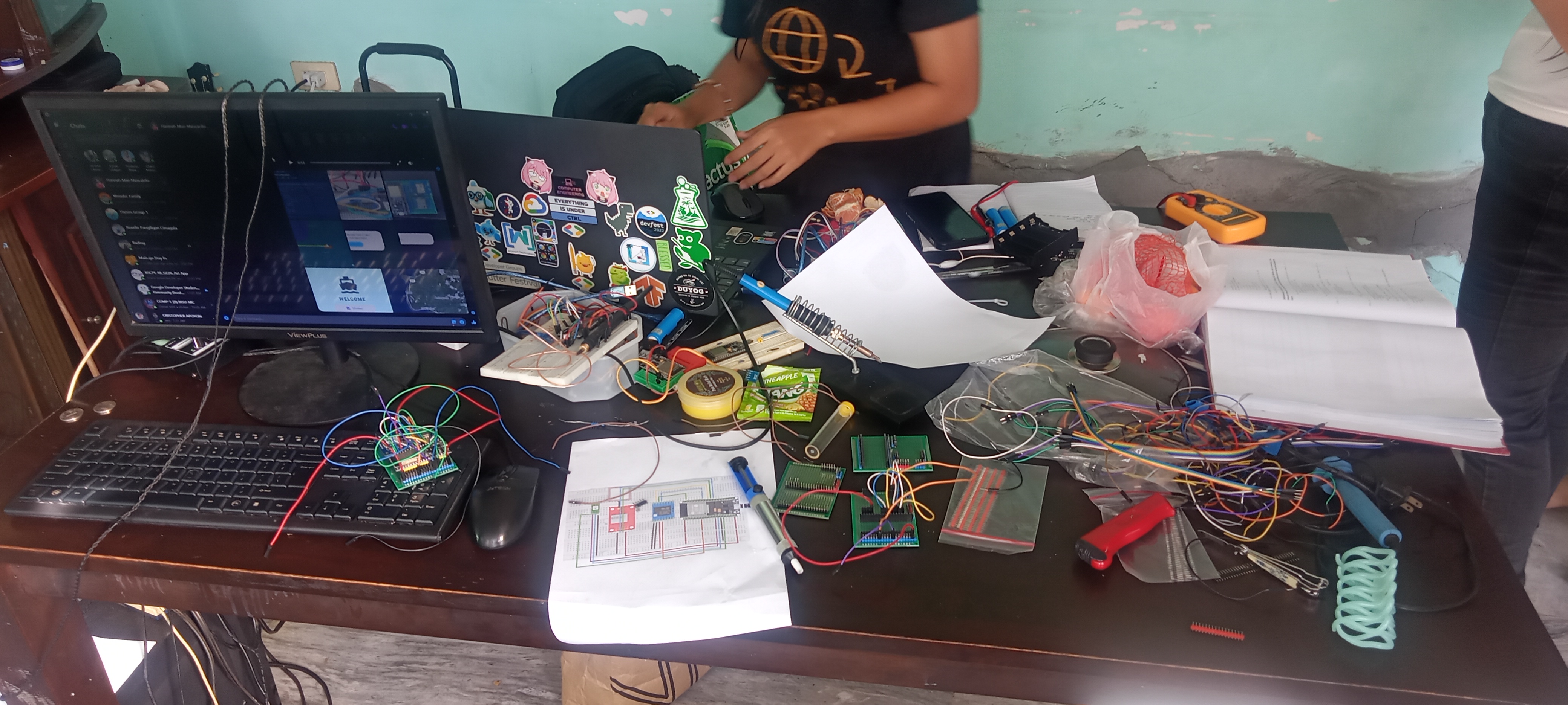
Materials & Tools
Challenges Overcome
Achieving maximum communication range of 882 meters in open sea conditions (target: 2+ kilometers)
Implementing XOR encryption for secure data transmission
Developing waterproof enclosures for harsh maritime environments
Integrating real-time GPS tracking with LoRa communication protocol
Optimizing power consumption for extended battery operation
Testing signal quality (RSSI/SNR) across various distances
Project Information
Team Members
Institution
Supervisor
Research Area
Project Overview
This undergraduate thesis project presents a comprehensive solution for enhancing maritime safety through the development of a LoRa-based communication network prototype specifically designed for monitoring small fishing boats, locally known as “bangka,” in the Philippines.
Problem Statement
The Philippines, with over 7,000 islands and approximately 2.2 million fisherfolk, faces significant challenges in maritime safety. Small fishing boats operating in remote areas often lack reliable communication systems when cellular coverage is unavailable, putting operators at risk during emergencies, mechanical failures, and adverse weather conditions.
Technical Implementation
Network Architecture
The system implements a STAR network topology where:
- Node devices are installed on individual fishing boats
- Gateway device serves as the central communication hub
- Mobile application provides real-time monitoring capabilities
- Firebase integration for cloud data storage and synchronization
Communication Protocol
- Frequency: 433MHz (ISM band)
- Range: Successfully tested up to 882 meters
- Data transmission: Boat ID, operator name, GPS coordinates, emergency status
- Signal metrics: RSSI (Received Signal Strength Indicator) and SNR (Signal-to-Noise Ratio) monitoring
Mobile Application Features
- Real-time boat tracking on interactive maps
- Historical location data with timeline visualization
- Emergency alert notifications for immediate response
- Boat and operator information management
- Multi-platform compatibility for emergency responders
Testing Results
Performance Metrics
- Maximum range: 882 meters in open sea conditions (expected: at least 2 kilometers)
- GPS accuracy: Tested and validated for maritime use
- Network reliability: Successful communication establishment
- Emergency response time: Real-time alert transmission
- Signal analysis: Inverse relationship between distance and signal strength (RSSI/SNR)
Testing Location & Methodology
Testing was conducted in the sea areas around Loon, Bohol, chosen for their representative maritime conditions and proximity to fishing communities. The open sea environment provided ideal conditions for range testing without physical barriers, allowing for accurate measurement of the 882-meter maximum communication distance.
Actual Test Results
Based on comprehensive field testing, the system demonstrated:
- Communication Network Functionality: 100% success rate across all three nodes
- LED Network Indicators: 100% accuracy in status indication
- GPS Location Accuracy: All measurements within 5-meter threshold (range: 0.21m to 1.81m)
- Maximum Range Achievement: 882 meters with intermittent connectivity
- Signal Degradation: Consistent inverse relationship between distance and signal quality
Technical Challenges & Solutions
Challenge 1: Data Transmission Method
Issue: Direct data transmission from ESP32 to Firebase proved ineffective
Solution: Implemented serial communication with PC running Python program for data processing
Challenge 2: Communication Range Limitations
Issue: Achieved range of 882 meters fell short of initial expectations
Solution: Identified need for antenna testing and potential upgrades for improved performance
Challenge 3: Signal Quality at Distance
Issue: Rapidly declining SNR and RSSI values as distance increased
Solution: Documented inverse relationship for future optimization efforts
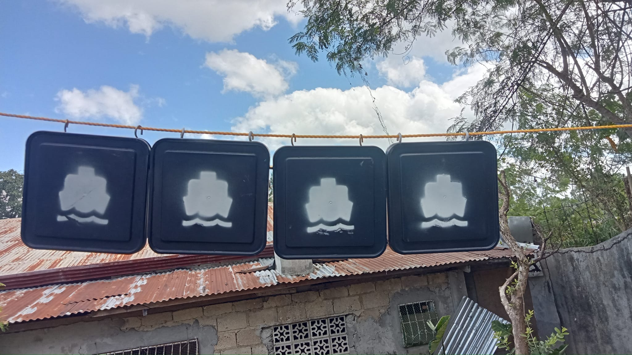
Challenge 4: Device Waterproofing
Issue: Need for protection against water damage in maritime environments
Solution: Identified requirement for upgraded waterproof casing in recommendations
Project Impact
Safety Enhancement
- Immediate emergency response capability for fishing boats
- Real-time location tracking for search and rescue operations
- Peace of mind for families of fisherfolk
- Improved coordination between boats and emergency services
Economic Benefits
- Reduced search and rescue costs through precise location data
- Increased fishing productivity with safety assurance
- Insurance cost reduction potential
- Support for sustainable fishing practices
Technological Contribution
- Proof of concept for LoRa in maritime applications
- Scalable architecture for larger deployment
- Open-source potential for community development
- Foundation for future research in maritime IoT
Cost Analysis
Hardware Costs (Per Unit)
- NodeMCU-32S: ₱349
- LoRa Module SX1278: ₱275
- GPS Module NEO-M8N: ₱599
- Antennas: ₱99
- Additional components: ₱258
- Total per device: ₱1,580
System Deployment (4 units)
- Total hardware cost: ₱6,480
- Development time: 8 months
- Testing phase: Comprehensive field testing
Research Limitations & Findings
Based on the actual research conducted at Bohol Island State University, the study demonstrated the feasibility of developing a networking prototype for monitoring small fishing boats. However, several limitations were identified:
Key Limitations Encountered
- Data Transmission Inefficiency: Direct ESP32 to Firebase communication proved ineffective
- Range Expectations: The 882-meter maximum range fell short of initial expectations
- Signal Quality Issues: SNR measurements consistently showed very poor signal quality
- Hardware Limitations: Need for waterproofing and antenna improvements identified
- Network Topology: Star network showed limitations requiring mesh network consideration
Validated Research Outcomes
- Functional Prototype: Successfully developed with minor adjustments needed
- Communication Performance: 100% functionality achieved for network operations
- GPS Accuracy: All location measurements within acceptable 5-meter threshold
- Real-time Capabilities: Emergency alerts and GPS transmission successfully implemented
- Cost Analysis: Complete 4-node system developed for ₱6,480 total cost
Performance Analysis
The study findings indicate that data delivery speed is dependent on distance. When nodes are positioned closer to the gateway, transmission occurs rapidly. However, as distance increases, there is a slower process of receiving data. Since testing was conducted at sea with no physical barriers, smooth data transmission was achieved as long as nodes remained within the operational range of 882 meters.
Signal Quality Results
- RSSI Performance: Ranged from -59 dBm (excellent at 235m) to -93 dBm (fair at 882m)
- SNR Performance: All measurements showed very poor signal quality (below -3.75 dB)
- Distance vs Signal: Strong negative correlation (-0.93) between distance and RSSI
- Network Functionality: 100% success rate for all communication network functions tested
7. Enhanced Authentication
While the current design allows access to authorized individuals and authorities for monitoring fishermen’s locations, there remains a possibility of unauthorized access if the mobile device is compromised. Future researchers should implement additional security measures such as biometric verification or multi-factor authentication to safeguard sensitive information and ensure system integrity.
Technical Implementation
Hardware Components Used
| Component | Description | Unit Cost (₱) | Quantity |
|---|---|---|---|
| NodeMCU-32S | Development board with Wi-Fi | 349 | 4 |
| SX1278 LoRa Module | 433MHz wireless transceiver | 275 | 4 |
| NEO-M8N GPS | Flight controller GPS module | 599 | 4 |
| Antennas | Signal transmission/reception | 99 | 4 |
| LED Modules | Visual status indicators | 15 | 4 |
| Buttons | User input interface | 10 | 4 |
| Battery | Power source | 99 | 4 |
| Wiring & Connectors | Electrical connections | 99 | 4 |
| Enclosure | Protective housing | 75 | 4 |
| Total System Cost | ₱6,480 |
Conclusions
Based on the research conducted, the study demonstrated the feasibility of developing a networking prototype for monitoring small fishing boats. Despite encountering challenges such as ineffective data transmission methods and limitations in range and signal quality, the prototype showcases potential for further refinement and deployment.
The speed of data delivery depends on the distance - if the node is near the gateway, transmission is fast, but as distance increases, there’s a slower process of receiving data. Since testing was conducted at sea with no barriers, there was smooth data transmission as long as nodes remained within operational range.
Key Research Findings:
- Successful prototype development with minor adjustments required for optimal functionality
- Communication network functionality - overall network, LED indicators, and mobile application functioned as expected
- Range limitations - achieved maximum distance of 882 meters, which fell significantly short of the expected 2-kilometer range
- Signal quality analysis - demonstrated inverse relationship between distance and both RSSI and SNR
- Data transmission challenges - addressed ineffective direct transmission by implementing serial communication with PC
- Waterproofing needs - essential for device durability in maritime environments
Recommendations
Based on the conclusions reached, the researchers suggest the following recommendations:
-
Antenna Enhancement Explore alternative antennas for LoRa to assess their impact on network performance and improve signal strength.
-
Network Topology Upgrade Transition from a star network to a mesh network configuration to enhance range, redundancy, and security.
-
Application Development Enhancement Develop a more advanced application to leverage collected data effectively and provide enhanced functionality.
-
Hardware Integration Improvement Replace the intermediary computer for data transmission with the gateway node and database, preferably on a Raspberry Pi or similar single-board computer, to streamline the process.
-
Security Enhancement Improve the existing encryption method to bolster data security and integrity.
-
Waterproofing Implementation Upgrade the casing to waterproof the device, preventing water ingress and ensuring operational integrity in maritime conditions.
-
Enhanced Authentication Security While the current design of the application allows access to authorized individuals and authorities for the purpose of monitoring fishermen’s locations, there remains a possibility of unauthorized personnel gaining access to the application if the mobile device is compromised. To mitigate this risk, future researchers may implement additional security measures to safeguard sensitive information and ensure the integrity of the system by implementing enhanced authentication mechanisms, such as biometric verification or multi-factor authentication.
Academic Achievement
This project was successfully completed at Bohol Island State University as an undergraduate thesis for the Bachelor of Science in Computer Engineering program in April 2024.
Research Team Roles
- Kenneth Harold Panis
- Daisy Marie Bernante
- Hannah Mae Mascardo
Academic Supervision
- Research Adviser: Julius C. Castro, MEng, CpE
- Institution: Bohol Island State University - Main Campus
- Department: Computer Engineering
- Defense Date: April 29, 2024
- Completion: May 2024
Research Significance
This project contributes to:
- Maritime Safety: Enhanced safety protocols for small-scale fishing operations
- IoT Applications: Practical implementation of LoRa technology in challenging environments
- Emergency Response: Improved coordination for search and rescue operations
- Academic Research: Foundation for future studies in maritime communication systems
- Community Impact: Direct benefit to local fishing communities in the Philippines
P.S. It’s not included in the paper, but one assumption affecting SNR rapidly is because we are sending big data. Implementing more sophisticated algorithms for compressing and decompressing the data might increase the communication range, as the signal itself was not the problem at 882 meters—rather, it was the SNR (signal-to-noise ratio) or the clarity of the signal that limited performance.
This project represents the successful application of LoRa wireless technology for maritime safety, demonstrating how modern IoT solutions can address real-world challenges faced by fishing communities in the Philippines.